Question

Asked By OceanDreamer59 at
Answered By Expert
Trent
Expert · 4.3k answers · 4k people helped
Step 1/4
Answer 1
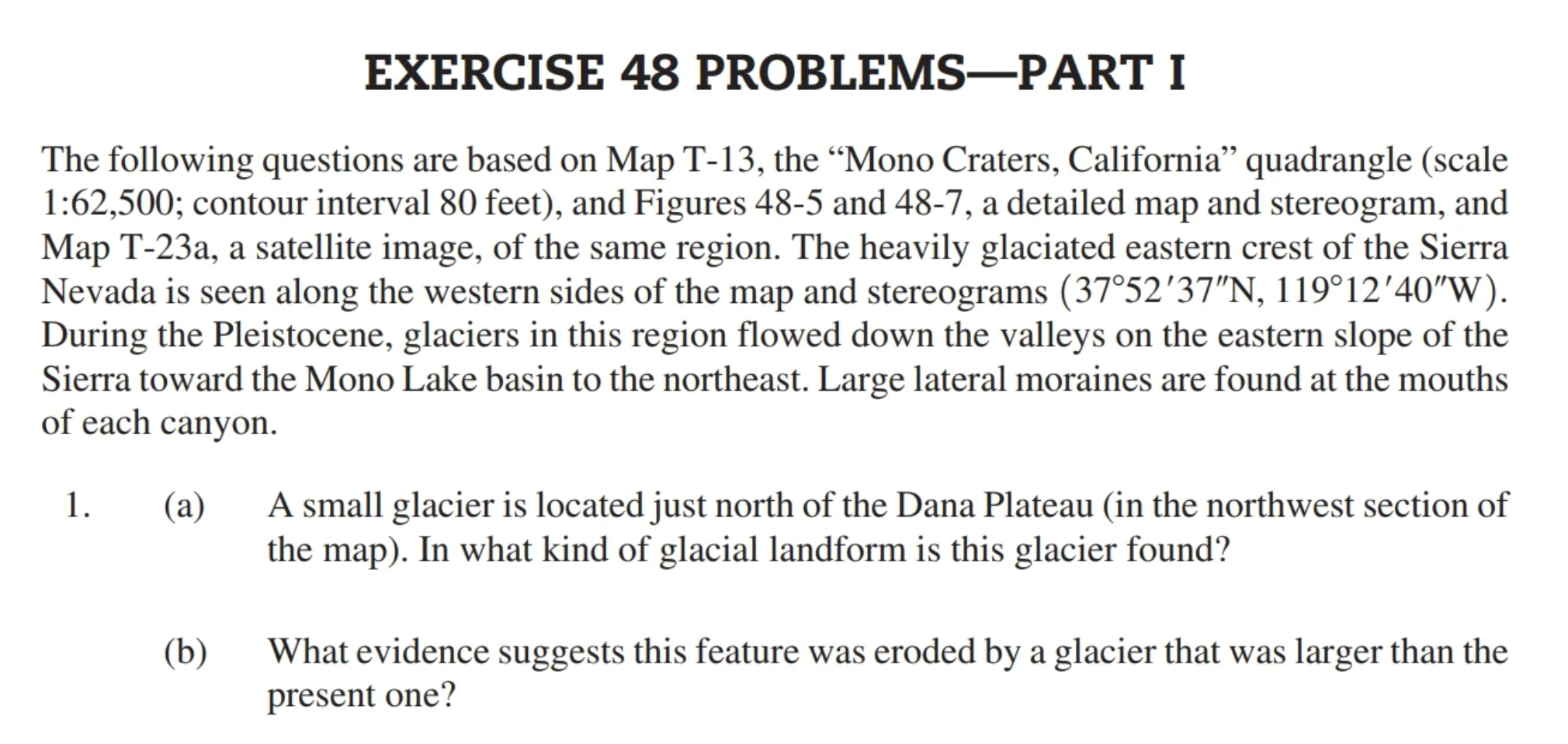
a) The statement "The Glacial landform is an arete" asserts that a glacial landform is specifically an arete.
b) This assertion is supported by the presence of a medial moraine, which serves as evidence of the arete's formation.
Explanation:
An arete is a distinct glacial landform that forms when two adjacent glacial masses meet, creating steep and sharp edges.
Explanation:
Explanation:
The presence of a medial moraine, which is a ridge of debris and sediment carried by a glacier and deposited in its center, can be a clear indicator of the formation of an arete. This moraine serves as evidence that glacial activity played a role in shaping the land.
Step 2/4
Answer 2
a) The statement "Mt. Gibbs is an illustration of an arete" suggests that Mt. Gibbs serves as an example of an arete.
b) It further explains that aretes are glacial landforms created when two adjoining glacial masses with steep and worn edges meet, resulting in the formation of a sharp pinnacle represented by Mt. Gibbs on a geographical map.
Explanation:
This answer highlights the specific example of Mt. Gibbs to illustrate what an arete is. Aretes, as mentioned, are formed when glaciers erode and shape the landscape. In the case of Mt. Gibbs, its prominent sharp pinnacle is a direct result of the action of glaciers that once existed in the region.
Step 3/4
Answer 3
The statement emphasizes the significance of ice formations and their lasting impact, even after the ice has melted. It suggests that a part of the ice maintains its structure, and the glacier's height is estimated to be around 500 feet based on latitude and longitude.
Explanation:
This statement underscores the lasting impact of glacial ice formations. Even after the ice melts, its structure can remain preserved, which is significant in understanding the geological history of an area. Additionally, estimating the glacier's height based on latitude and longitude provides insight into the scale of these glacial formations.
Step 4/4
Answer 4
This answer provides historical and geographical context about the Pleistocene landscape in western Nevada, specifically the presence of thin mountain ranges and interconnected lakes forming Glacial Lake Lahontan. It explains how changes in climate since the last Ice Age led to the disappearance of glaciers, ultimately resulting in the drying up of Lake Lahontan. It also mentions Walker Lake's location and its water source, the Walker River.
Explanation:
This answer delves into the geological history of western Nevada during the Pleistocene era. It describes the presence of mountain ranges and interconnected lakes, including Glacial Lake Lahontan, which was a prominent feature of the region. It explains how the warming climate post-Ice Age led to the retreat of glaciers and the eventual disappearance of Lake Lahontan. The reference to Walker Lake's location and its source, the Walker River, provides context about the hydrology of the region.
Final Answer
Summary:
Answer 1
Glacial landforms, like aretes, are identified by the presence of features such as medial moraines.
Answer 2
Mt. Gibbs exemplifies an arete, formed when glaciers with steep edges meet, creating sharp peaks.
Answer 3
The lasting impact of ice formations, even after melting, is significant, and glacial heights can be estimated using latitude and longitude.
Answer 4
Western Nevada's Pleistocene landscape featured thin mountain ranges and Glacial Lake Lahontan, which disappeared due to climate change, and Walker Lake is sustained by the Walker River.
🧑🏫 More Questions
👉 Interested in exploring further?
Chrome Extension
1. Search answers from our 90+ million questions database.
2. Get instantly AI Solutions powered by most advanced models like GPT-4, Bard, Math GPT, etc.
3. Enjoy one-stop access to millions of textbook solutions.
4. Chat with 50+ AI study mates to get personalized course studies.
5. Ask your questions simply with texts or screenshots everywhere.